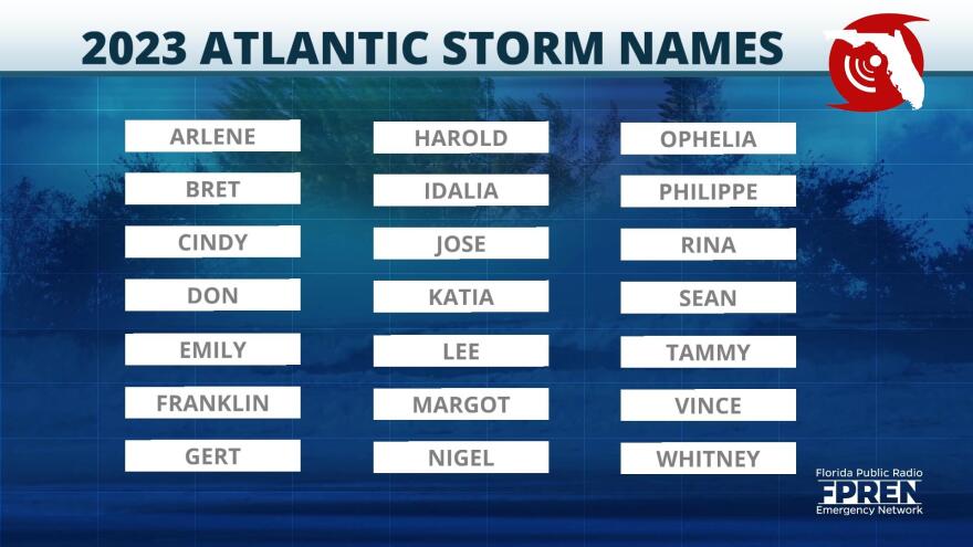
MIAMI — Tropical Storm Arlene, the first named storm of the Atlantic hurricane season, formed Friday in the Gulf of Mexico on a track taking the cyclone south toward the western tip of Cuba.
National Hurricane Center forecasters said in a 1:30 p.m. advisory that Arlene had sustained winds of 40 mph (65 kph) and was located about 265 miles (425 kilometers) west of Fort Myers, Florida. It’s moving south at about 5 mph (7 kph).
No storm watches or warnings have been posted for Cuba or Florida. Forecasters say the storm could fall apart before reaching any land.
Tropical storms have winds of at least 39 mph (63 kph); anything 74 mph (119 kph) or higher is designated a hurricane.
Meanwhile, the Atlantic hurricane season officially began Thursday and runs through Nov. 30. Last year’s season had 14 named storms, with extensive damage caused by Hurricanes Ian, Nicole and Fiona.
Arlene is expected to bring rounds of heavy rain and the potential for flooding through late-week, especially across portions of South Florida.
Parts of the central and southern Florida Peninsula have been hit with rounds of flooding rains the past several days, and Arlene will continue to push waves of heavy showers over the same areas through Saturday.
In addition to a flooding threat, Florida’s Gulf Coast along the Peninsula will likely experience gusty winds, rough surf, and an increased risk for high rip currents.

Florida Public Radio Emergency Network Meteorologist Megan Borowski said that an uptick in thunderstorms caused by the system could lead to local flooding.
Borowski added that a Flood Watch is in effect for inland counties through this evening. She also said that few thunderstorms could become strong enough to produce damaging winds or quick tornado spin ups.
Borowski encouraged residents to take appropriate action if warnings are issued. In the event of a Flash Flood Warning, people should seek higher ground. If a Tornado Warning is issued, head to the inner most room on the lowest floor of a sturdy building.

With hurricane season officially underway, please continue preparing and always be ready to take action when necessary. Here are some great safety and prep resources:
https://www.floridadisaster.org/planprepare/preparing-for-hurricane-season/
https://www.weather.gov/safety/hurricane
https://floridastorms.org/zone-home/?station=WUFT
The Florida Storms app is a one-stop shop for all of your hurricane preparation and safety needs along with helping you track everything going on in the tropics.

The Florida Public Radio Emergency Network and The Associated Press contributed to this report.

