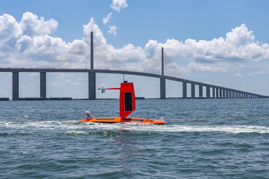
While most people are running from the dangers created by massive Hurricane Helene, there are those who steer themselves into harm's way.
While they aren't actually putting human lives in danger, the folks at Saildrone are putting their assets on the line by sailing equipment into the teeth of raging storms for their 2024 Hurricane Mission.
"NOAA and Saildrone have two Saildrone USVs that are expected to intercept Hurricane Helene as the storm makes its way toward Florida," Jenn Virskus, director of Marketing for Saildrone, Inc., said. "As of 10 a.m., we are about 100 nautical miles NNE of the edge of the storm and about 100 nautical miles due west of Tampa."
The company's SD1083 captured one photo already near the storm, which shows 4 meter waves.
The Helene-bound drone is part of the fourth year of Saildrone and NOAA sailing a fleet of uncrewed surface vehicles (USVs) into hurricanes to better understand how these dangerous storms form, track, and intensify.
The mission officially started in August with 12 vehicles stationed in six operational areas identified by NOAA as having a high probability of intercepting a storm.
Their missions are part of ongoing research into how and why some relatively mild tropical storms rapidly intensify into major hurricanes, which is particularly destructive when it happens just before landfall. Of all recorded weather disasters in the U.S., hurricanes have had the most significant impact: Between 1980 and 2021, hurricanes were responsible for over $1.1 trillion total in damages and 6,697 deaths.
With near-record warm ocean temperatures in the Atlantic Ocean, La Nina conditions developing in the Pacific Ocean, reduced Atlantic trade winds, and less wind shear, all of which tend to favor tropical cyclone formation, NOAA is predicted an 85% chance of an above-normal season.
Saildrone Explorer USVs are 23 feet long and carry a payload of sensors to measure air, surface, and water temperature and humidity, barometric pressure, wind speed and direction, salinity, and wave height and period. To withstand major hurricane conditions—winds over 110 mph and waves that exceed 50 feet—they have a shorter and stronger “hurricane wing,” similar to a reefed sail on a sailboat.
Saildrone USVs sail autonomously along prescribed routes, which are defined by Saildrone pilots according to weather conditions and to meet mission objectives. Saildrone’s science partners in the mission at NOAA’s Atlantic Oceanographic & Meteorological Laboratory (AOML) and Pacific Marine Environmental Laboratory (PMEL) will work closely with Saildrone mission control to guide the saildrones into oncoming hurricanes.
Powered solely by renewable wind and solar energy, the Saildrone fleet will stay at sea for the duration of the mission, which will last through October.
WGCU is your trusted source for news and information in Southwest Florida. We are a nonprofit public service, and your support is more critical than ever. Keep public media strong and donate now. Thank you.


