The National Hurricane Center is forecasting Idalia will make landfall on Wednesday as a Category 2 hurricane somewhere along the Florida Gulf Coast.
Hurricane, Tropical Storm and Storm Surge Watches are now posted. The cone extends from near Panama City/Tallahassee through Sarasota, but remember Hurricane Ian hit outside the early cone forecasts — therefore, caution is urged in preparing for any weather eventuality.

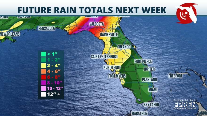
Highest impacts are currently expected across the Big Bend Coast where 7-11 foot storm surge inundations are possible along with 5-10”+ of rain. Impacts decrease but are still significant as we move away that area.
Afternoon models show enough inconsistency that the storm’s track and intensity will likely change at least slightly the next 24-36 hours.

According to the NHC, A slow, possibly erratic, motion is expected overnight. A generally
northward to north-northeastward motion at an increasing forward speed is expected on Monday and Tuesday. On the forecast track, the center will move over the eastern Gulf of Mexico on Monday and Tuesday, and approach the northeastern Gulf coast late Tuesday.
Buoy observations indicate that Idalia's maximum sustained winds have increased to near 45 mph (75 km/h) with higher gusts.
Additional strengthening is forecast, and Idalia is expected to become a hurricane over the southeastern Gulf of Mexico by early Tuesday. Additional strengthening is likely while Idalia approaches the northeastern Gulf coast.
Tropical-storm-force winds extend outward up to 70 miles (110 km) from the center.
WGCU is your trusted source for news and information in Southwest Florida. We are a nonprofit public service, and your support is more critical than ever. Keep public media strong and donate now. Thank you. The Florida Public Radio Emergency Network contributed to this report.


