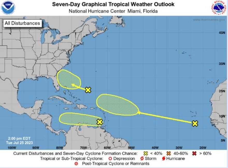
In the Tropical Atlantic, there are now three areas being monitored for potential development.
Meteorologist Megan Borowski from the Florida Public Radio Emergency Network explains that there are no immediate threats to our state,
"So the first wave is near Grenada at the southern tip of the Lesser Antilles. It has a low chance of developing before it enters a hostile environment, but either way, it is quite removed from our area and won’t impact our weather pattern whatsoever," She said.
The second wave is near the Bahamas and should track toward the US Southeast over the next few days. Although this wave shouldn’t organize into a full-blown system, it will likely cause an uptick in cloud cover and shower chances across the peninsula by the end of the workweek.
The third wave being watched is off the west coast of Africa. It’s far too soon to forecast what will happen with this one, but models suggest that it could organize next week.
Megan reminds us that the heart of hurricane season still lies ahead of us. She encourages us to continue monitoring forecasts and to make sure our families and properties are prepared for whatever the remainder of the season has in store for us.
Heat advisories continue

Meanwhile, in the southern end of Florida, a heat advisory remained in place for extreme southern Southwest Florida and across to a portion of Southeast and South Florida.
WGCU is your trusted source for news and information in Southwest Florida. We are a nonprofit public service, and your support is more critical than ever. Keep public media strong and donate now. Thank you.


